The 19th and the beginning of 20th centuries
A plan to strengthen Baku walls was worked out after occupation of Baku by the Russian troops, which realized military operations in Azerbaijan in 1796. The Tsarist army left Baku after Yekaterina II’s death in March, 1797 and the expansion of Icherisheher walls in the south-west direction, roughly till the area where the old hotel “Inturist” is situated had stopped.

In 1806, Baku joined the Russian Empire and after a year a new plan of the territorial growth of the city outside the medieval walls was arranged. According to this project, it was meant to build a fortification beyond the borders of the city, on the seacoast, at a free, flat and open land. However, the project of the fortress made in 1807 hadn’t been realized.
A general layout of Baku was worked out in 1822 and it confirmed the emergence of additional rectangular blocks.
On October 6, 1835, “A layout of Baku fortress, expansion of fortification and vorstadt (suburb, suburbia) beyond the Fortress” was prepared. For the realization of the project, primarily, it was necessary to evict all evidents, to give them plots for building up within the region of vorstadt on easy terms and assure substantial means for these purposes. Nevertheless, this project also wasn’t fulfilled.
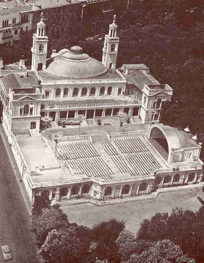
At present ”The Palace of Happiness”
At that time beyond the bounds of the fortress, there was also suburb, inhabited a long time ago – rabad, which was tightly connected with handicraft and commercial life. Caravansaries, mosques, bath-houses and other structures, also large green area - out-of-town “Khan’s garden” were built here.
A new general layout of Baku was worked out in 1843 and it was the beginning of the new stage in the development of Baku. In the 50s of the XIX century the development of urban planning in a new district of Baku was observed.
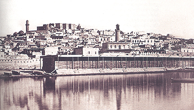
From the second half of the XVIII century, the fortress and rabad were one spontaneously developing organism. The construction of rabad with the area of 15-16 hectares, occupied the northern part of the fortress along Shamakhi Road. Around the fortress and on the borders of rabad, there were Absheron gardens.
The alley connecting Shamakhi gates with the vorstadt highway was already marked on the master plan of 1854. “Master plan for supposed allocation of Baku port buildings” was approved in 1855. From one side, the suggested area for port constructions (the modern area of “Azneft”) abutted upon the fortress moat, and it abutted to advanced stony landing stage from the other side.
In 1858, the area set aside for Navy Department, including the area of Bibi-Heybat, comprised an area of about 4 square. miles.
The provincial center was transfered to Baku after the earthquake, which turned Shamakhi into a heap of ruins on May 15, 1859. However, there weren’t any buildings suitable for numerous provincial institutions. Within the pinion walls the territory with the area of 21,5 ha did not allow to successfully solve the problem of fortress urbanization. Old residential houses were pulled down in the vorstadt and four-storeyed houses were being constructed. The population inflew to Baku began to increase. Key position of the city in the economy of Transcaucasia was outlined in the beginning of 60s of the XIX century.
In the 1860s, the town had only three reservois – Khan’s, Sisianov’s, and Komendant’s. In 1867 the embankment was supplied with water system, fountains and other structures were built. There was built a square around Sisianov’s basin, which later became a shady garden. In 1862, drafted storage facilities along the water front were worked out. In 1865, permission was granted for the destruction of the fortress walls.
This period of the urban planning in Baku coincided with the creative activity of one of the greatest Azerbaijani architects – Gasim bey Hajibababeyov. Gasim bey executed the construction of the central square of the vorstadt, so-called Parapet – one of the organizing links of the urban planning. The huge building by this architect was a large caravansary (now “Araz” cinema), designed in 1868. The project of caravansary graphically was made by Mashadi Mirze Gafar Ismayilov, who later became an eminent architect. In the course of 30 years Mashadi Ismayilov devoted himself to designing and construction of buildings, mainly in Baku, and left substantial architectural inheritance.
In the early 1870s, many oil refineries occupied big areas of municipal lands. An increasing development of Baku began after the law concerning the abolition of farming system in the oil industry in 1872. In 1876, Black town, named this way because of blackened industrial buildings, appeared partially on glasslands of Keshla settlement and municipal pasture, where local residents grew gardens. In 1874, a Swedish national Robert Nobel came to Baku and he founded a company that became the Oil production partnership of the Nobel brothers. In 1889, Caspian-Black sea Society was founded by the representative of French capital F.Rothschild.
The area of factories of Caspian-Black sea Society, chemical factory of Shibayev, and residential settlement of Nobel – Villa Petrolea, which constructed in the continuation of Black town, was so-called White town. In 1878, a large district, further named Taza-pir, was built around the Taza-pir mosque. Chemberekend village grew spontaneously without following any building by-law.
According to the plan of 1878, a huge area composed of three independent administrative and territorial parts in Baku: Baku in the center, Bailov in the south with the Admiralty and industrial zone Black town in the east. Quarters in Baku now reached 120,20 new quarters appeared in Bailov, and 30 in the Black city.
The building of the railway station was constructing in the north-eastern part of the city, between residential and industrial zones in 1880. In 1883, Baku-Tbilisi railway was put into operation. After intensified development of Bibi-Heybat oil-fields, which began at the turn of 1870s-1880s, the first residential quarters were appeared along the Shikhovo village.
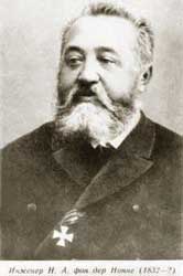
Rapid rate of building up of the city from Bailov cape to White city required to draw-up a complete general layout of Baku. The members of the city council affirmed the general layout of Baku city prepared by engineer N.A. fon der Nonne in 1898. However, architectural and planning indicators of the layout was undeveloped. Highways for connection of regions weren’t provided, allocation of green plantations was not also concerted with the general planning structure of the city other shortcomings existed in fon der Nonne’s project. The plan by fon der Nonne with the consequent editorship of the engineer Mammad Hasan Hajinski remained a single document over the regulation of Baku built-up.
At the turn of the XIX-XX centuries Baku was accounted as a big city, equipped with services and facilities, where intensive trading and business life was running. Ornate streets with passages, big stores, hotels, offices of famous commercial and industrial firms and private banks appeared in the center. Palaces belonging to local millionaires and mansions of enriched merchandisers, theatres and clubs, educational institutions were put over the general artistic silhouette of the city. As of city outskirts they were unattractive by their build-up and absence of services and facilities.
With a purpose of impeding unauthorized activities of the population, mainly outsiders, the council “cultivated” settlements on free municipal lands – Muslim, Armenian, Molokan, planning of which composed a part of citywide planning structure. Settlements system prevented free lands seize. In connection with the construction of water supply system from the Shollar sources, situated on the distance of 190 km from Baku, economic life of the city livened up. In 1911, Hajinski had already designed the whole northern and north-eastern districts of the city, more perspective for residence and built-up.
In 1914, Baku and the pastures occupied the territory of 4972,58 ha. The area of Baku within the precincts of the city was 2300 ha. There were only 1018 quarters in Baku, 800 of them were entirely or partially built up. By the year of 1913 there registered 9388 private plots or domains. Baku’s population increased for 33,4 times in the years of 1855-1917. In 1850 its population was 7400 people, and by 1918 its population was above 248000. During 100 years, Baku which was small suburban town turned into the largest industrial center.
February bourgeois revolution in Russia in 1917 made to put off the decision of many economic problems of the city, which was involved in booming social and political life. Until the establishment of the Soviet power in Azerbaijan, special planning works in Baku weren’t held at all.
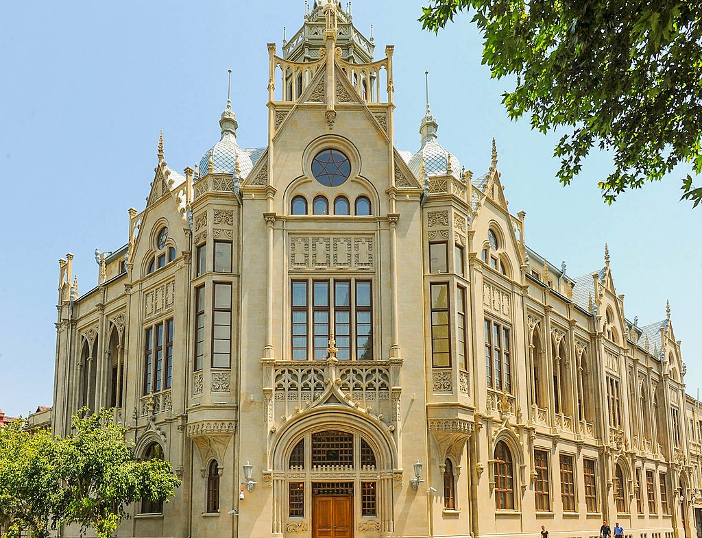
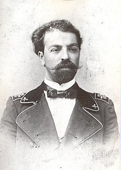
In the late XIX – early XX centuries buildings, such as the National Art Museum of Azerbaijan (1888-1890, architect N.A. fon der Nonne), ANAS’s Institute of Manuscripts (1898-1900) and Baku Soviet (1900-1904, architect of both is I.V. Goslavskiy), Taza-pir mosque (1905—1914, architect Z. Ahmadbeyov), “Ismailliyye” (now ANAS’s Presidium, 1908-1913, architect İ.K. Ploshko), the Opera and Ballet Theatre (1911, architect N. Babayev), the house of M. Mukhtarov (1911-1912, architect İ.K. Ploshko), the Hospital of ophtolmology (1911-1912, architect Z. Ahmedbeyov) and the Azerbaijan State Philharmonic Hall (1911-1912) were constructed. The constructions according to architectural solution, which built with means of the well-known Baku millionaires and philanthropists H.Z. Tagiyev, M. Nagiyev, M. Mukhtarov, Sh. Asadullayev and others, reflected European architectural style at that time.
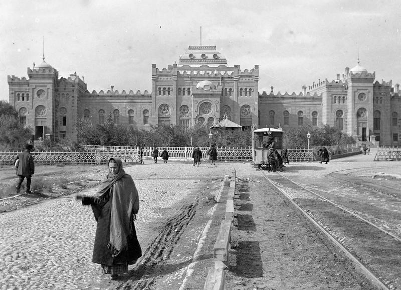
Accomplishments were realized in the sphere of architecture during the Democratic Republic of Azerbaijan (1918-1920), which exists in a short period of time. Grandiose buildings of Baku – H.Z. Tagiyev’s female school and “Ismailliyye”, which burned by Armenian-Dashnak gangs in 1918, were reconstructed according to general architect of the city Z. Ahmadbeyov`s layouts during the Democratic Republic of Azerbaijan. More than 1500 houses and administrative buildings belonging to XVIII –the early XX centuries have been protected in Baku.
References used:
Fatullayev Shamil. Urban planning in Baku in the 19th and early 20th centuries. Baku: Sharg-Garb, 2013, p. 7-137. (in the azerbaijani language)
Azerbaijan National Encyclopedia. The third volume. Baku: The Azerbaijan National Encyclopedia Scientific Center, 2011, “Baku” article, p. 64.(in the azerbaijani language)
Fatullayev Shamil. Urban planning in Baku in the 19th and early 20th centuries. Baku: Sharg-Garb, 2013, 2013, p. 7-137. (in the Russian language)